The brief
The South Downs National Park Authority (SDNPA) is responsible for leading the development and implementation of the South Downs Partnership Management Plan and the Local Plan.
A key priority for the SDNPA is to restore an ecologically functional network of semi-natural habitats across the South Downs National Park (SDNP). Under the National Planning Policy Framework, the SDNPA is required to identify and map all components of the local ecological networks.
The project has two key objectives
The development and application of a methodology to assess semi-natural habitat connectivity across the SDNP.
To create a queriable map-based habitat- potential model of the SDNP. This will highlight the locations which would be suitable for the creation, connection and restoration of agreed priority habitats.
Thomson Ecology was commissioned to
- Develop a model to measure semi-natural habitat connectivity across the National Park
- Create maps that identify opportunities for agreed priority habitats across the National Park
- Supply the models in both ArcGIS and QGIS formats with supporting documentation and user training.
What we did
- We undertook a literature and best practice review, and from this identified the most appropriate models to employ.
- Using ArcGIS, we modelled all existing semi-natural habitat.
- Further modelling was undertaken to identify habitat opportunities.
- The habitat modelling was further developed to run as a tool in both ArcGIS and QGIS, enabling the analysis to be rerun.
The outcome
Thomson Ecology delivered GIS data along with technical reports that highlighted the locations which would be suitable for the creation, connection and restoration of agreed priority habitats. The models used were also provided as tools that could be run in both ArcGIS and QGIS allowing the SDNPA to update both the data and the parameters used in the model.
-
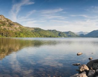
South Downs National Park AuthorityLocation
-
South Downs National Park
Services offeredThe maps we produced for this project were used in the SDNP Local Plan and their team continues to utilise both the maps and tools we created to inform important ecological decisions across the South Downs National Park.Thomson project manager, habitat connectivity mapping -
Our other projects


We cover all aspects of environmental consultation – from smaller surveys through to strategic projects.

At Thomson, we strive to deliver a pragmatic and innovative approach to environmental compliance.
Working in partnership with our clients, our team of environmental specialists ensures objectives are met, with maximum efficiency for our clients, and minimal impact on the natural world.